Refreeze risk after melt
Published 11:30 pm Friday, January 31, 2014
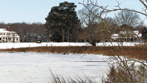
A frozen Bennett’s Creek provides evidence of the near-record low temperatures recorded in Suffolk this week — as low as negative 4.
City of Suffolk spokeswoman Diana Klink has reported that all Suffolk roadways, including residential streets, had been plowed of snow as of Friday afternoon.
Some small sections of roadway were unable to be cleared in some instances, she said, such as in cases of parked cars blocking plows.
According to climate data from the National Weather Service and The Weather Channel, the mercury overnight Wednesday dropped to 4 below zero — within a single degree of Suffolk’s coldest-ever recorded temperature, which was 5 below zero in January 1985.
From there, though, the temperature has shot north, reaching a high of 49 Friday and turning accumulated snow into rivulets.
The weather service’s seven-day forecast has Suffolk temperatures mostly remaining mild through next week, though with a low around freezing Monday night and Thursday dipping to below freezing at 27.
Forecasters are predicting more snow, though mixed with rain, for next Friday.
A forecast low of around 26 overnight Friday could have caused refreezing, posing a risk to motorists, she said.
The city’s Public Works Department was closely monitoring bridges and overpasses for instances of refreezing, she said. “We still want to encourage caution,” she added.
“All bridges and overpasses had been treated with brine solution,” she said, “and since that time we’ve been also using a salt mixture, as well as continually plowing, to ensure they remain clear and safe for our drivers.”