Tracking Sandy’s fury
Published 9:48 pm Monday, October 29, 2012

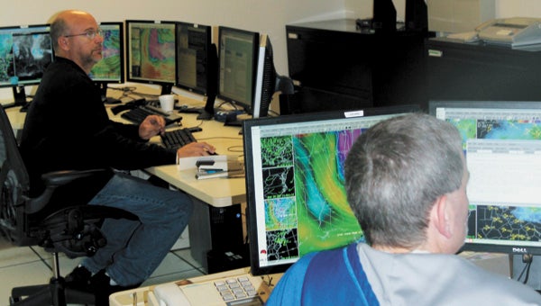
Meteorologists at the National Weather Service office in Wakefield keep a close eye on Hurricane Sandy Monday, tracking her path and impact on banks of computer screens and compiling briefings for government officials and media organizations.
To the casual visitor, a hurricane experienced from the operations room at the National Weather Service office in Wakefield is a little confusing.
Phones ring constantly, meteorologists race between banks of computer screens featuring fluctuating shapes in a variety of colors, and volumes in the bookcases have titles like “Numerical Prediction and Dynamic Meteorology.”
But to the 23 staff, mostly sharing nine-hour shifts to keep Hurricane Sandy under 24-7 observation, it all makes perfect sense, meteorologist-in-charge Jeff Orrock said.
“We have to deal with everything,” Orrock said, including land and ocean wind speeds, rainfall, coastal flooding and storm surge levels, to name a few.
“We end up having to break it up among different forecasters. Each person will take an element and really focus on that.”
Orrock, who started working with the National Oceanic and Atmospheric Administration in 1994, said he and a few others in the building beside Route 460 have been pulling 12-hour shifts during Sandy.
He described one of the main challenges as helping to coordinate two or three daily briefings to governors and more frequent reports to state and local emergency services managers.
The Wakefield office is part of a weather service district that stretches roughly between Prince Edward County to the west, Dorchester, Md., to the north, Bertie, N.C., to the south, and east to the Atlantic.
“About every hour we get to brief somebody, just about,” Orrock said. “It’s our job to be working with the folks making the decisions.”
Suffolk is on the “back end” of Sandy’s fury, he said late Monday afternoon, adding that water levels had peaked and winds were turning westerly.
“It’s pretty much what was expected,” he said. “We were telling folks not to get too wrapped up in the track of the storm. Whether it hits the Delaware coast or New York,” Sandy was always going to have the same impact on Hampton Roads.
“This is much more like a massive nor’easter for us,” Orrock continued, adding that tide levels were as predicted and storm surge forecasts were “right on.”
“We have had 60 mile-an-hour wind gusts, but pretty much you have to be on the water to experience something that strong.”


